
Breaking The Map
Dwimmermount Mapping

First thing let’s start with the breaking of the map. I have two major issues that I want to correct.
The primary is the rivers. I don’t like how they’re drawn so I’ve taken the rivers out and I’m going to fix them. They’ll flow in the same hexes but they’ll get drawn better on the map. There’s some really janky angles that … just … no.
Second is the scale of the map. I don’t like five mile hexes. ACKS is based on a six mile hex which is a superior scale to use. As I noted in the comments of the previous article some of the advantages are the average person can see three miles, half a hex. If you’re on a hundred foot high hill then you can see twelve point two miles or roughly two hexes. An average person walks about three point one miles per hour, close enough to half a hex for my math. So in an eight hour day the average person can walk, with a half hour break for lunch, about twenty three point two five miles ... which is close enough to four six mile hexes assuming flat terrain.
For more details on why six mile hexes are superior refer to Hydra’s Grotto excellent article ‘In Praise of The Six Mile Hex’.
The region remains forty four by thirty seven hexes which is sixteen hundred and twenty eight hexes at six miles each (thirty one point eighteen square miles) for a total of fifty thousand and seven hundred and sixty one square miles. That an increase of roughly forty four percent from the five mile hex map.
Plus I’ve put a better grid that won’t fade into nothingness when I zoom in for details and removing the settlements and the geographic descriptors. Plus I’ll tinker with the upper right hand corner water hexes. After all of that we get this …
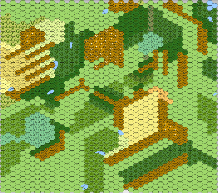
Right now that’s a map without a greater geographic home. In the sense that on the world of Telluria we don’t have an idea of where this fifty thousand square miles of map is located. I scanned over the text of the regions and a few points that might help me geo-locate this region came up. Glaciated mountains, Trees, Swamps, and Desert Dunes
Permanent Snow Peaks or Glaciated Mountains
Basically these are mountains that are at a high enough altitude based on their position to the equator that snow and ice don’t melt and persist even through the warmest months. There are quite a few peaks in the region. The Wintertops, obviously, The Demon Claws, The White Mountains, and The Thunderhome Moutains. This chart shows the rough elevation that a mountain needs to exceed based on its position relative to the equator to have year round snow and ice.

So while the presence of the peaks isn’t a great data point it’ll help when it comes time to figure out just how high those mountains are.
Trees
Again I’m lacking on information to work with here. The Northern Forest of Ur is mentioned to be a dense coniferous forest.
Conifer forests are found all over the world but they get more common the farther north you travel at least until the artic. That seems to hold on this map as well with the pine trees being more common towards the top of the map. What I’m not seeing is any tropical forests so that elimates a proximity to the equatorial regions at least. Elimation is a data point after all.
Swamps and Wetlands
There are two major regions on the map. The Makrono Marsh in the north and the Murklands near the center. Now these look to be freshwater types due to their positions but again not a great data point to work with. But at least we know that they’re not bogs.
Desert Dunes
On the western edge of the map we’ve got desert dune tiles. You tend to find deserts around the thirty degrees north and south regions, that’s a rough guideline especially since we’re just dealing with a couple of tiles at the edge of some mountains and badlands. Plus we’re got the fuckery of conifer forests just the other side on the moutains from the desert. It’s not that odd in the real world but its still the first piece of geolocation that is solid.
Based on all of that we’re likely looking at a region similar in location to the Central US. Colorado region, of a sort. I’m going to guess about thirty-seven north to forty-one north.
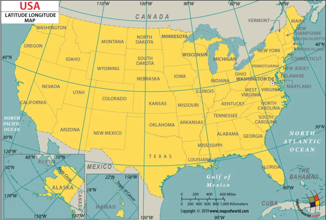
One of the reasons I like the rough Colorado region for this is the climate

Just look at that glorious mess, you’ve got a mix of everything in there. From Cfb and Dfb on the edges of the Plains going up into Subarctic and Tundra up in the mountains. It demonstrates the mess of temperatures and climates that we’re going to see in the Dwimmermount region

The elevation map works as well. It’s a mix of the mountains and valleys which looking at the Dwimmermount region is what we’re going to get with all those closely packed mountains. Now going with this region means that the snow peaks, the permanent ones are going to have to be in excess of nine thousand to eleven thousand feet roughly. But with that body of water off the NE corner of the map it’s going to be lower due to the higher levels of moisture that will be coming off that and dumping on the mountains. Best guess is likely eight thousand to nine thousand feet and above will be permanent snow.
Colorado also comes in at one hundred and three thousand and seven hundred and thirty square miles which is roughly double the size of our region. I like it.
Next article I’m going to start to look at the climate, winds, elevations so I can figure out a bit of the weather for the region.
If you like the work I’m doing here then consider throwing me a few bucks and if not at least subscribe so I know that I’m not screaming into the void more than usual.