

In the last article I covered the Vargar River and finally I’ve gotten time to get to the next river in the area … the Murkwater River.
Hilariously when you search the text of the Dwimmermount pdf ‘Murkwater’ doesn’t appear. The river is listed on the map …
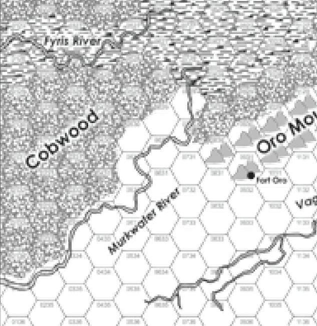
… but that’s it. I like that. It gives me room to work. So carrying on the tradition of trying to stick with the course of the terrain as much as possible I sketched in the Murkwater.
This lead to a few problems. First the Murkwater as described above comes in from off map and quickly fades out after entering the Murklands Swamp. Second I didn’t have the boundaries of the Murklands Swamp figured out. So I had to work out the Murklands ahead of the schedule that I planned on. That was fine but it pushed getting this article out a bit.
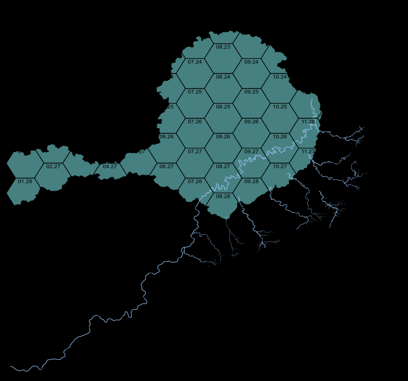
In places the river will look a little odd but keep in mind that I’ll be describing the Murklands Swamp fully in a future article and that will tie the rivers in the area together. You get a preview of the shape of the Murkwater Swamp below.
I went back and forth on how to handle the Murkwater River. I really didn’t like the river fading out at the edge of the swamp. That’s a thing that does happen with rivers entering swamps … but … they also can move through a swamp and create pathways for travel. The more I thought on this idea I liked it. The Murkwater being a vast swamp with several rivers running through it. The idea is also supported by the next of the ruined city within the swamp. That there was ‘a series of dams and dikes that kept the swamp at bay’.
A floodplain area that was settled, unwisely, and as the Thulian Empire fell into ruin they were unable to support the structures that protected them and the area flooded.
So I decided to extend the Murkwater river through the area. Perhaps the original river ended in an reservoir at the edge of the floodplan with a dam blocking its course. The Thulians were advanced enough to understand the resource from trapped water pressure. When that dam failed … the Murkwater broke loose and charted a new course.
I liked this idea more and more as I thought on it. So I went with it. Plus ruined dams and dikes in the area create places for adventure with monsters naturally wanting hardened lairs.
The Murkwater is keeping with the text of the book until Hex 07.28 and then I went my own way with it. If you look at the course of the river you see an interesting effect that I learned about how rivers flow.
When a river interacts with a swamp, which is really just a big shallow lake in a sense, the river tends to slow and it also tends towards changing to a slower, shallow series of winding courses. So when I sketched out the Murkwater I kept the course straighter and the turns in the river more gradual before the swamp but when I drifted into the swamp itself I made the turns much more frequent as the river spread out, its energy being absorbed by the mass of water and dense plant life. A more zoomed in view, kill me, would show the path below breaking up into multiple separating and rejoining streams but for this level of detail the single course works. I have the Murkwater ending in 11.25, which looks strange, but that’s because it’s going to join up with the Fyris River and a few others that are going to come down from the elevation on the southern Demon Claw range just to the north of the map and continue to become the Makrono River.
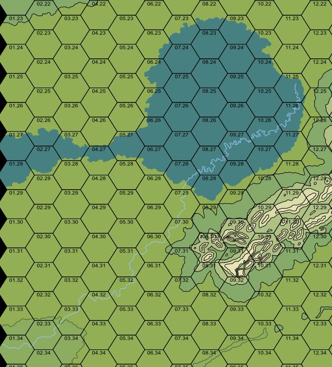
Now that I had the main body of the Murkwater detailed in I wanted to add all the flow that would be coming off the north side of the Oro Mountains and draining down adding to the Murkwater Swamp. Those major flows that managed to make it down to the Murkwater swamp would have had dams and dikes to contain them originally now long gone.
The majority of those flows coming down off the Oro Mountains, and like the original Murkwater River, quickly fade out as their energy is absorbed by that large body of water and all that vegetation. Having broken past dikes and dams most of them didn’t have the energy to not be absorbed. In a few spots I wanted to add enough flow that the waters would join up with the Murkwater River namely down in Hexes 07.29, 07.30 and 11.26. The proximity was close enough to justify it. I cut out the main flow of the Murkwater to give you a look at how the drainage was working from this level of detail.
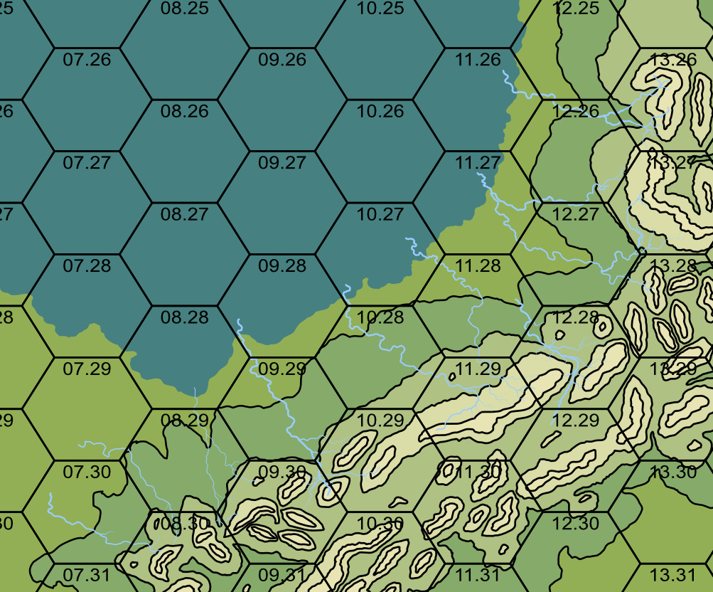
When I add the Murkwater River back in …
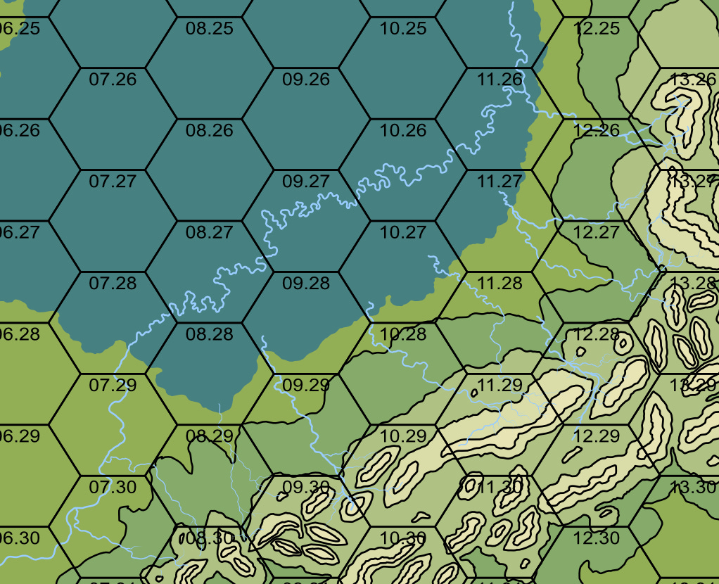
Now you’ll notice a few places where the rivers draining out of the Oro Mountains are ending abruptly. In those places I’m going to add lakes but I wanted to wait on those until I got all the regional flows charted and then do one large pass over the region and add them in.
I’ll add in a view without the terrain as well …
This is just my side gig, as you can tell from my publishing schedule. My full time job takes up a good 60 hours of my week so if you like this kind of content subscribe and/or throw me a few bucks.